
ADVANCED MINE MONITORING SYSTEM
Preventing slope failures before they happen
Autonomous LiDAR monitoring that supports operational decisions, geotechnical analysis and the safety of everyone working on site.
Key points
3D data for safer and smarter open-pit operations.
Detects deformation
Continuously measures surface displacement and progressive slope movements across the entire monitored area.
Sends alert notifications
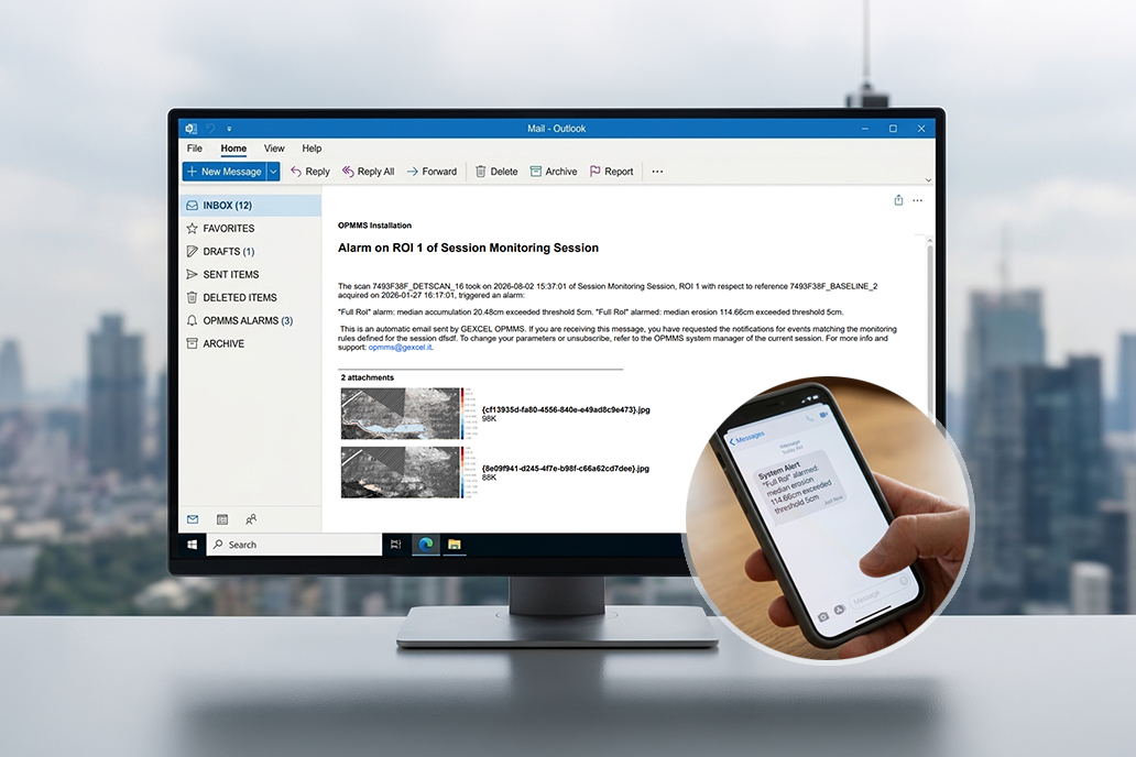
Automatically triggers email or SMS alerts when user-defined deformation thresholds are exceeded.
Creates 3D models
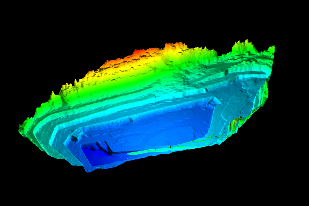
Unlike radar or prism-based monitoring, LiDAR captures the entire quarry as a measurable 3D surface, not just individual points.
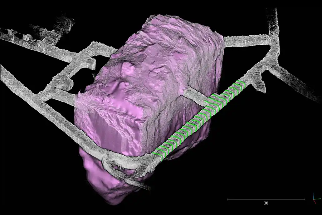
Extracts 3D information
Generates volumes, DTMs, heatmaps, crest and toe lines and other 3D derivatives supporting subsequent geotechnical analysis.
How it works
ON SITE
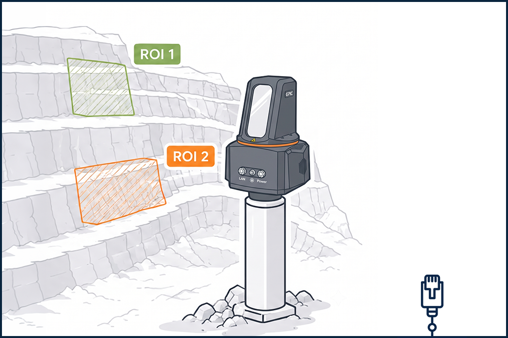
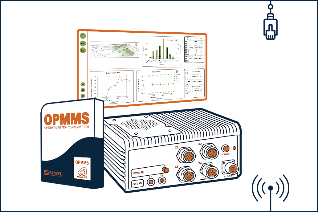
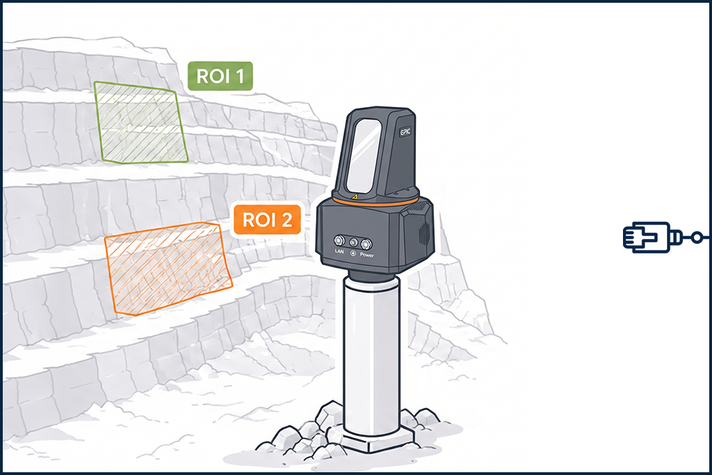
A long-range terrestrial laser scanner connected to a rugged control unit with inbuilt software: continuous monitoring, automatic data processing, automatic alerts, 3D data storage.
off site
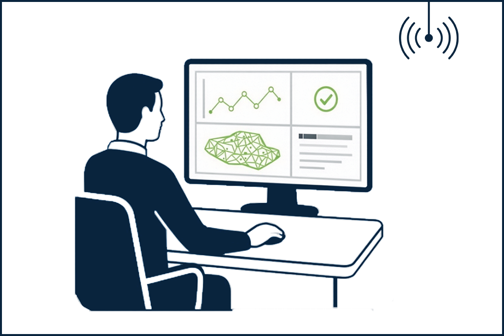
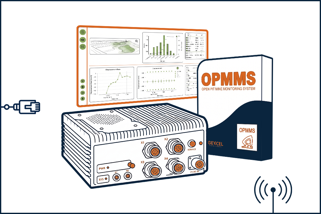
Not mandatory. Monitoring review, volume computation and advanced analysis with the optional Reconstructor software.
ON SITE
A long-range terrestrial laser scanner connected to a rugged control unit with inbuilt software: continuous monitoring, automatic data processing, automatic alerts, 3D data storage.
off site
Not mandatory. Monitoring review, volume computation and advanced analysis with the optional Reconstructor software.
technical specifications
Laser scanner Elite Scan T1000
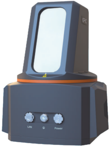 Maximum range 1.4 km on highly reflective surfaces
- Minimum range 1.5 m
- Ranging accuracy ≤ 5 mm at 100 m
- Laser pulse repetition rate 100~2000 kHz
- Beam divergence 0.35 mrad
- Field of view 360° × 100°, −40° to +60°
- Angular resolution ≤ 0.001°
- Operating temperature −20 °C to +50 °C
- Power supply 18~33 V DC, about 50 W
- Weight and dimensions ≤ 7 kg, 210 × 163 × 270 mm
- Laser class 1
- Panoramic camera about 100 megapixels, 360° × 11
Sensor data from the EPiC LiDAR manufacturer’s site, retrieved on 9 September 2026.
Rugged Control Unit
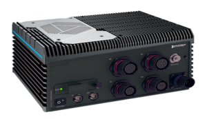
- Processor Intel Core i7-10700TE 4.5 GHz
- Memory 32 GB
- Operating system Microsoft Windows 10 Enterprise LTSC 2019
- Storage 500 GB M.2 Samsung 970 EVO Plus + 1 TB SATA SSD 2.5″
- Warranty 1 year
OPMMS Software
- License type single, installed on the control unit
- Monitoring continuous, 24/7
- Regions of interest multiple ROIs, each at its own resolution
- Alerts email and SMS on defined thresholds
- Remote access configurable on the same subnet
Challenges
Mining decisions require reliable information


Undetected ground movement
Small deformations develop long before visible cracks appear. Without continuous monitoring, the early warning signs are easily missed.

Unsafe survey conditions
Highwalls and unstable benches become inaccessible precisely when accurate measurements matter most.


Unexpected production interruptions
Emergency evacuations and unplanned equipment shutdowns hit both productivity and operating costs.


Slow decision-making
Manual surveys and fragmented datasets delay analysis, cutting the time available to respond before conditions worsen.


Limited situational awareness
Traditional monitoring returns periodic snapshots, and many technologies detect surface deformation without quantifying volume change: it is hard to see how slope conditions actually evolve.
Capabilities
What OPMMS does
Continuous 24/7 monitoring
Autonomous data acquisition in harsh environments
Automatic alerts
Email and SMS notifications based on defined thresholds
Multi-area monitoring
Multiple ROIs at different resolutions
Targetless setup
No prisms, reflectors or control points required
Flexible scanning frequency
Set it by risk level and operational needs
Historical comparisons
Use any previous scan as the reference
Automatic change detection
Centimeter-level, over large areas
Masking function
Exclude moving vehicles, equipment and vegetation
Remote access
View changes and manage the system from anywhere
Secure data management
Reliable storage of scans and monitoring data
Advanced data analysis
Volumes, DTMs, heatmaps and other 3D data for geotechnical analysis
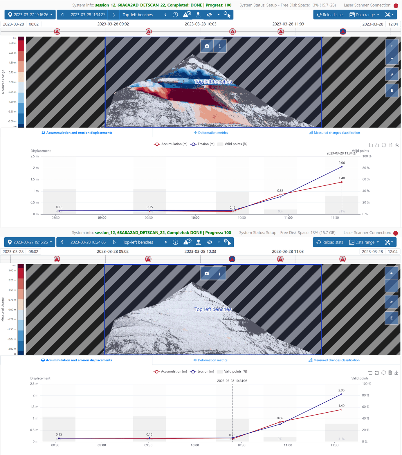
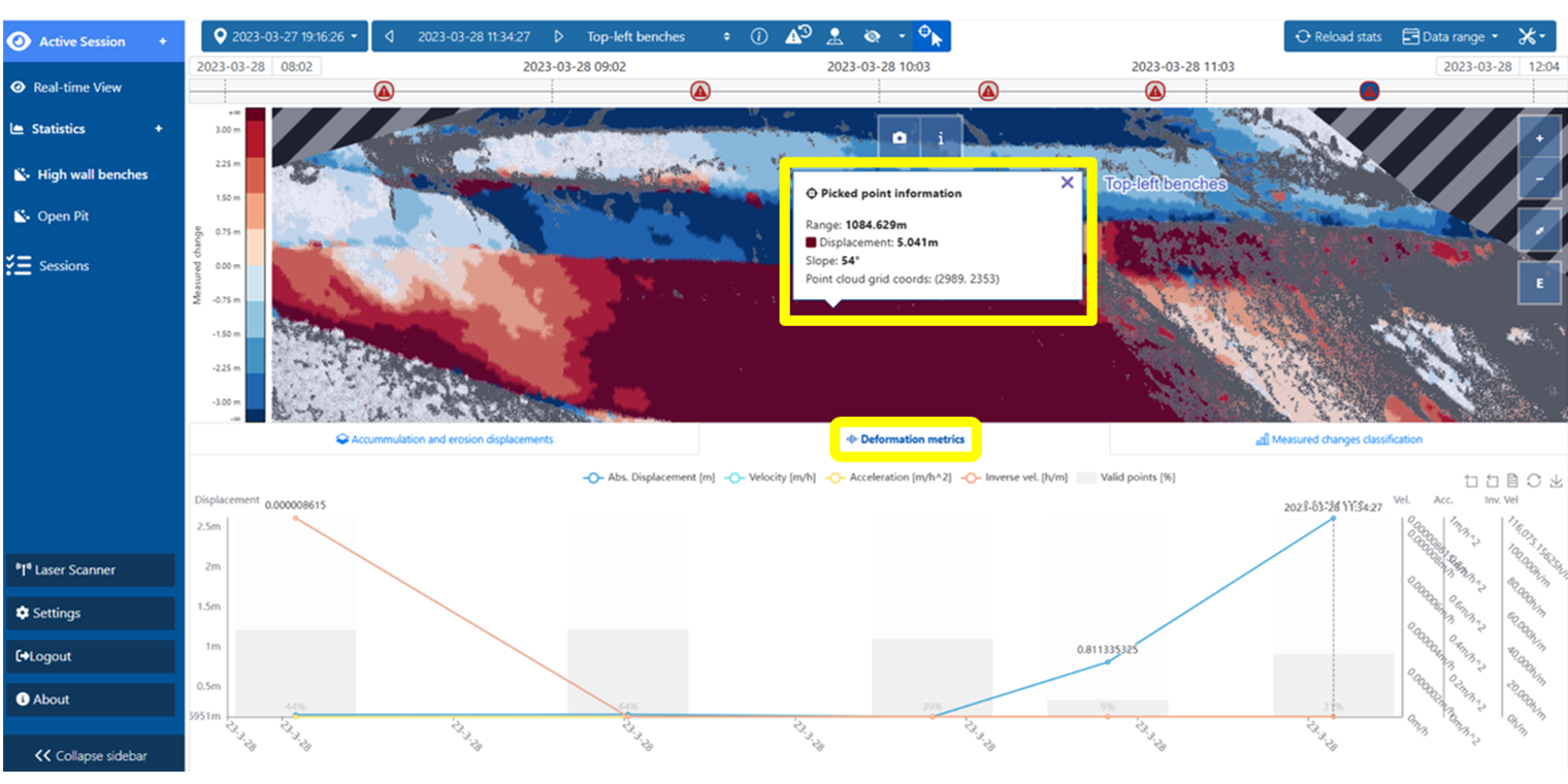
Heat Map + graph details — inspecting individual points: 3D coordinates, displacement, range from the scanner
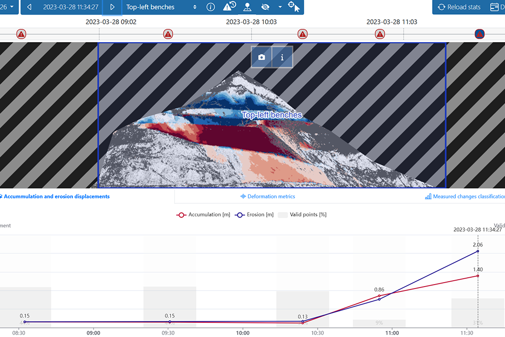
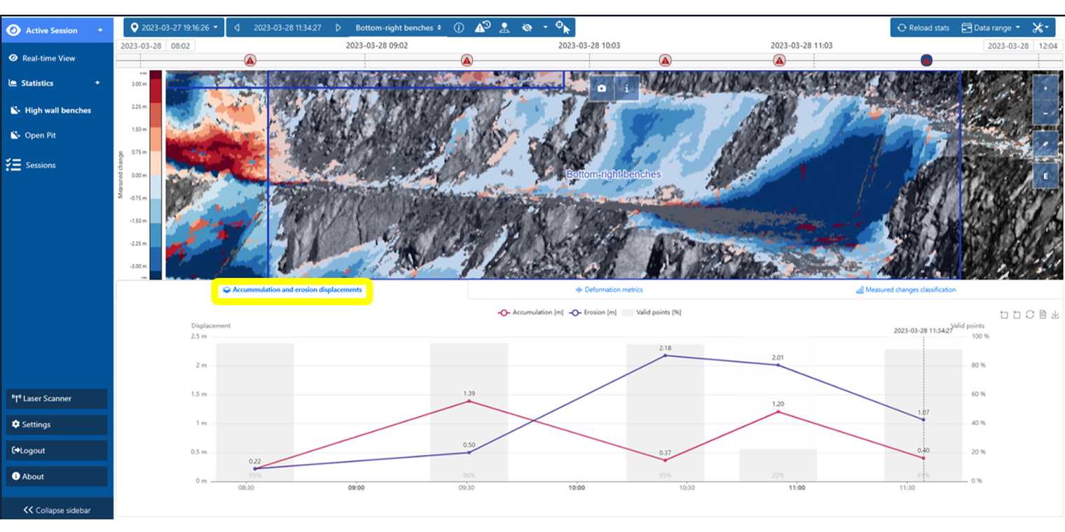
Heat Map + ROI + graphs — several regions of interest tracked together, with accumulation and erosion curves
Advanced 3D analysis
Support for geotechnical analysis
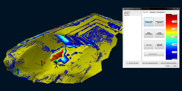
Displacement and deformation analysis
Identification and tracking of unstable zones over time
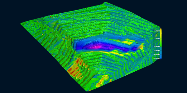
Volume computation
Total volume and cut-and-fill volume
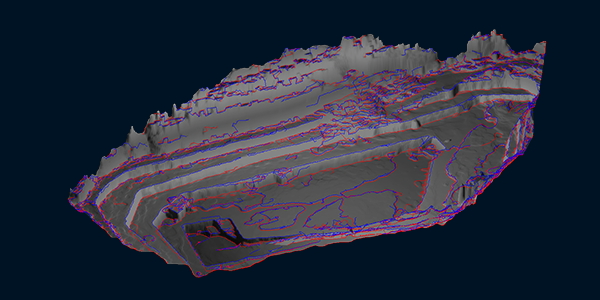
Breakline detection
3D polylines for crest and toe
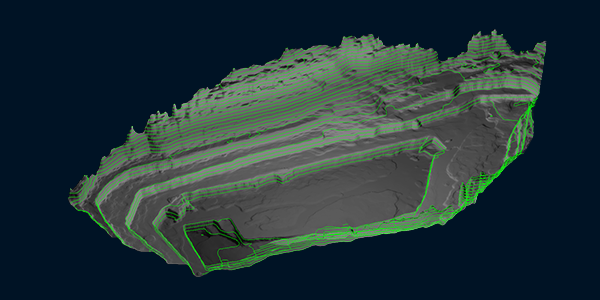
Contour and profile generation
Automatic contour lines and terrain profiles
Workflow
From acquisition to alert, with no manual steps
OPMMS turns continuous LiDAR measurements into information you can act on.
01
Scanner setup
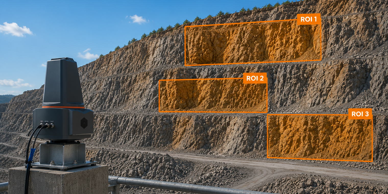
02
Reference acquisition
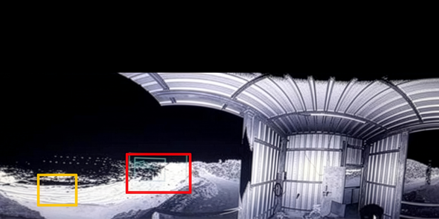
03
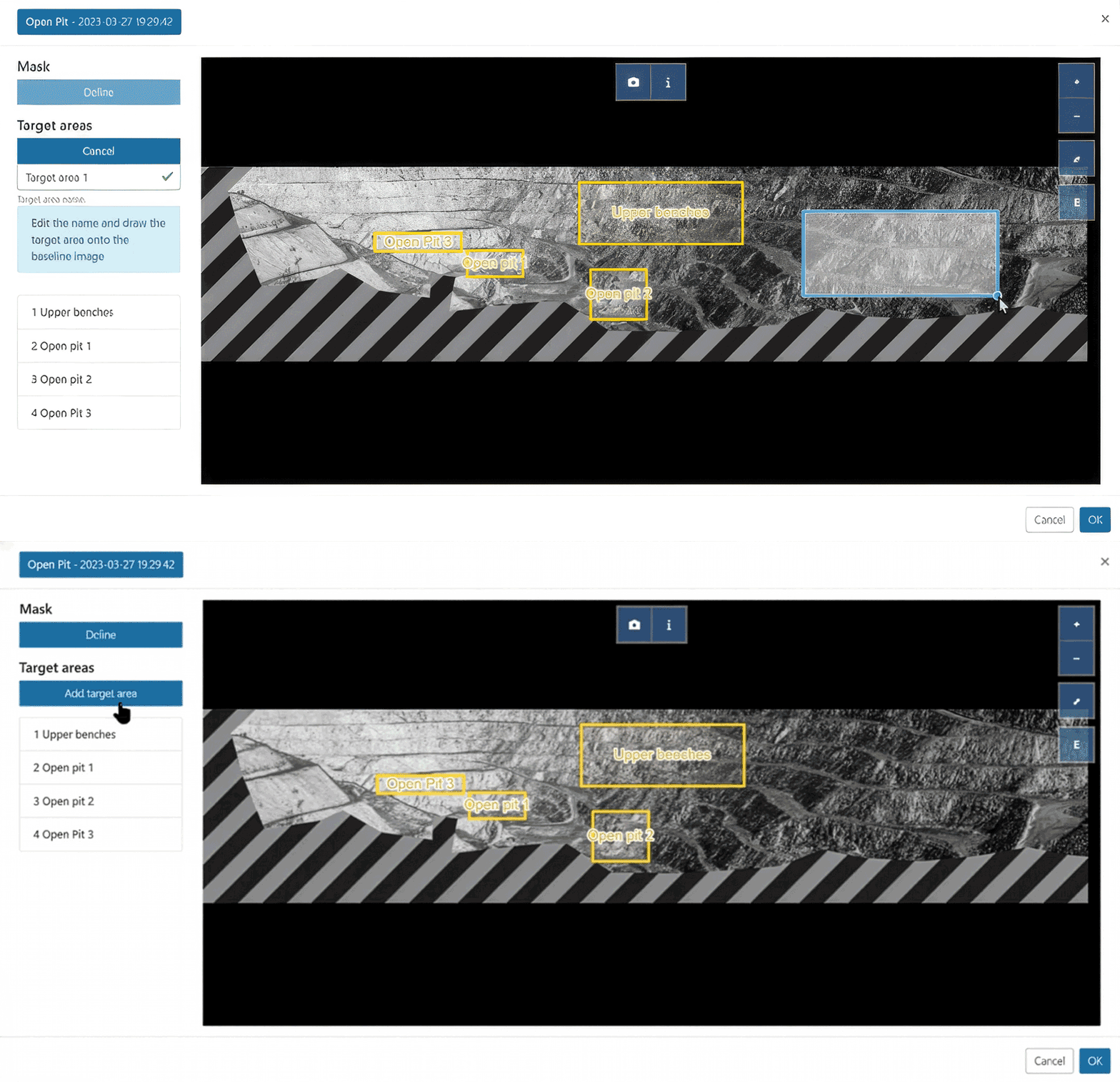
ROIs definition
04
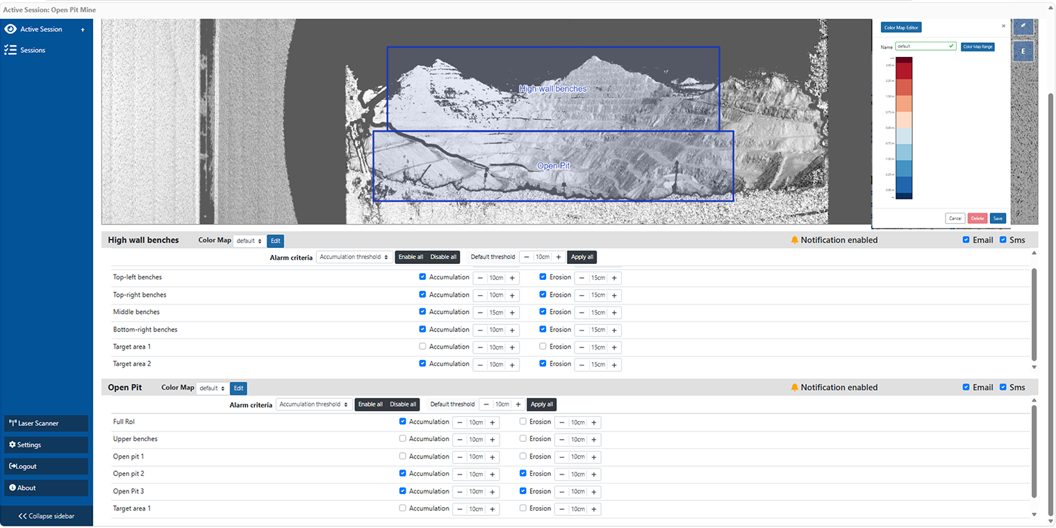
Thresholds setup
05
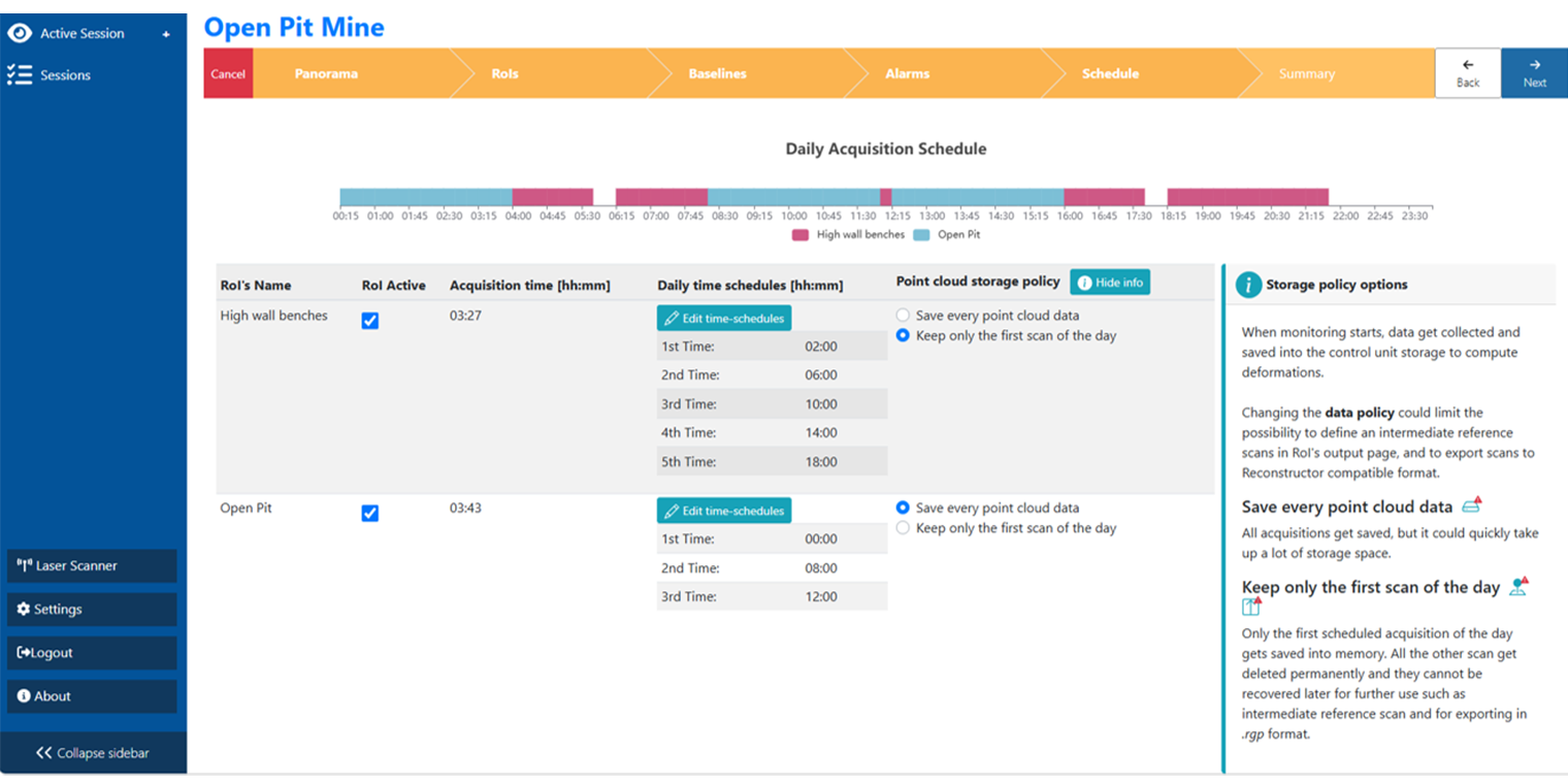
Scans scheduling
06
Automatic comparison
07.1
Accumulation and erosion displacements
07.2
Deformation metrics
07.3
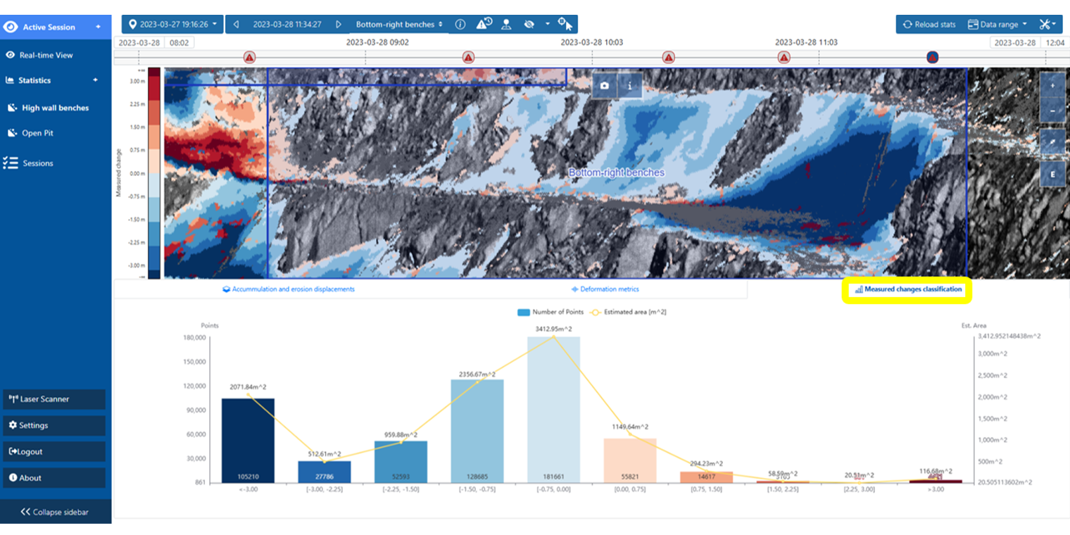
Measured changes classification
08
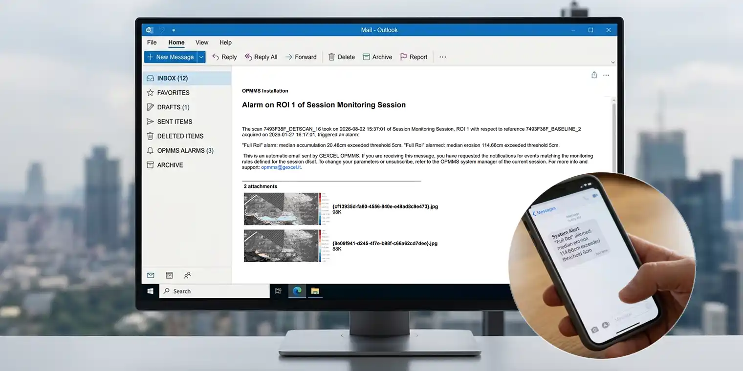
Automatic alerts
+
Support for geotechnical analysis
The next step, off site
Applications
Where it is used
Slope stability
- Continuous monitoring up to 1.4 km, keeping personnel and equipment out of hazardous areas
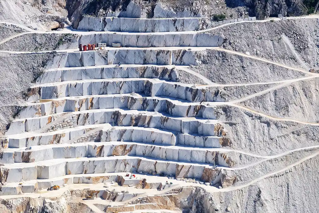
- Highwalls and benches monitored continuously, so progressive deformation shows up early
- The whole pit covered without target prisms
- Works alongside robotic total stations when point measurements help
Rockfall and debris flows
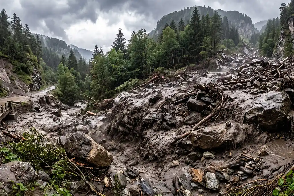
- Entire rock faces monitored, spotting progressive instability before a fall
- Automatic notifications when thresholds are exceeded
- Before-and-after 3D comparison measuring location, extent and volume
- Advanced analysis for mitigation planning
Mine blasting
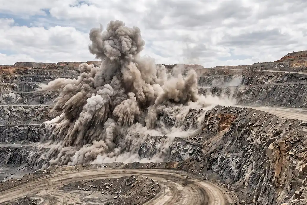
- Automatic scans just before and immediately after each blast
- Immediate notifications when safety thresholds are exceeded
- The synchronized enclosure opens only during scanning, shielding the LiDAR
Geotechnical support
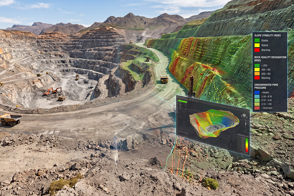
- Volumes, DTMs, heatmaps and 3D derivatives feeding geotechnical analysis
- Crest and toe extraction, cross-sections and contour lines
- Export to standard mining and CAD formats
Case studies
OPMMS in action
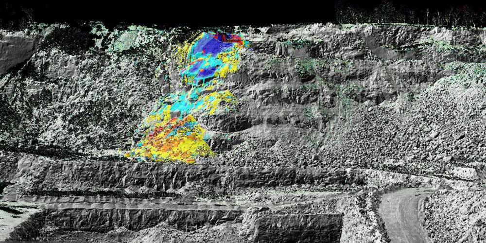
Open-pit mine, Georgia, USA
Automated slope and pre/post-blast monitoring
Continuous wall stability tracking and volumetric analytics near a residential area.
5 pages · English
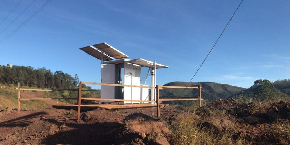
Fertilizer mine, South America
Integrated slope monitoring solution
Dual sensor fusion, robotic total station plus OPMMS, in extreme environments.
5 pages · English
Offer
What the system includes
Elite Scan T1000 laser scanner
It watches the whole wall from kilometres away, so nobody has to approach unstable areas. One-year warranty.
Rugged Control Unit
The system works on its own on site: it processes, decides and stores locally, with no computer to man. One-year warranty.
OPMMS Software License
Single license installed on the control unit: continuous monitoring, automatic processing, alerts and 3D storage.
Remote installation and configuration
We put it to work remotely: configuration, first access for large data storage and setup fine-tuning.
First-year support
System start-up under remote control, maintenance and up to 10 hours of remote support.
Frequently asked questions
How difficult is it to install OPMMS on site?
Installation is fast and straightforward. No physical targets, ground control points or field calibration are required. Once the sensor is mounted on a stable structure and connected to power and network, the system is ready to operate.
Can OPMMS monitor multiple areas simultaneously?
Yes. Multiple regions of interest can be configured within the same scene, each with independent schedules, thresholds and alert settings.
What level of movement accuracy can OPMMS detect?
OPMMS detects surface displacements at the centimeter level, depending on scanning distance.
Does the scanner need to operate continuously 24/7?
No. Scanning frequency is fully configurable. Each ROI can have its own schedule: more frequent where risk is high, less frequent in stable zones.
How does OPMMS manage large historical datasets?
With an optimized data management system that stores history while keeping performance. Deformation trends can be analysed over months or years.
How does weather affect monitoring accuracy?
OPMMS is based on laser scanning, so very dense dust, rain or fog can affect a session and produce false positives. The alert email includes a heat map, so recipients can immediately tell whether the alarm is genuine.
How are alerts sent when a threshold is exceeded?
By email or SMS, including displacement maps and location information.
Can data be exported to third-party mining or CAD software?
Yes. Point clouds, DTMs, crest and toe polylines and deformation maps export to DXF, DWG, LAS and E57.
Can I have a demo?
Yes. Tell us about your application and we will arrange the most suitable demonstration.
Reduce risk. Protect people. Perform better.
Talk about your open-pit: we will contact you back.
E. info@gexcel.it | P. (+39) 030 6595001
HEADQUARTERS
Via Branze 45, I-25123 Brescia (BS) ITALY
Follow us!
CONTACT US